Operational Earthquake Forecasting
Earthquakes can be destructive and deadly. How can we better predict earthquakes to reduce risks and save lives? Our work on earthquake forecasting has led to multi-national developments in government, industry and community responses that continues to this day.

Operational Earthquake Forecasting (OEF) has been mandated and implemented at a multi-national scale to quantify, communicate and manage risk to society from natural and induced seismicity.
Our research on quantifying earthquake predictability and forecasting power under uncertainty has informed the development of OEF protocols and its application.
The results of this research have benefitted:
- local populations at risk
- government agencies responsible for risk assessment, licensing and regulation
- local authorities
- civil protection agencies
- emergency responders
Our research, led by Professor Ian Main, explores multiple aspects of earthquake predictability and forecasting in a probabilistic framework that accounts for uncertainty.
Our approach was developed from multiple standpoints, including:
- stochastic modelling
- statistical seismology
- statistical physics
- rock physics
It has informed the framing of time-dependent OEF protocols for natural and induced seismicity, including the International Commission on Earthquake Forecasting (ICEF) report.
International Commission on Earthquake Forecasting for Civil Protection (ICEF report)
The ICEF report summarised the state-of-the-art research in OEF and developed protocols for its application in risk assessment and communication. Professor Ian Main was one of three principal members of the writing team for the ICEF report, which also cited five of his papers on OEF.
It prompted multi-national developments in public policy and service provision related to earthquake risk reduction that continue to this day.
Raising public awareness and preparedness
The ICEF report also highlighted the critical importance of risk communication during a crisis, and the effective communication of the relevant issues in times of repose, so that practitioners and the general public can act in an informed way during a crisis.
In addition, our researchers have contributed significantly to the public understanding and discussion of earthquake risks through interaction with a range of national and international media outlets in articles or interviews, including the Guardian, Scotsman, and commentary in Nature.
Professor Ian Main and Dr Mark Naylor also featured in the documentary 'Chasing Quakes', based on our work in supporting Italy's National Institute of Geophysics and Volcanology during the Norcia-Amatrice sequence in 2016-17.
Highlights
We have provided some highlights from some of the countries applying OEF systems based on the ICEF report.
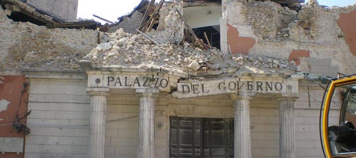
The Italian National Geophysical and Volcanological Institute (INGV) operates a live OEF system based on the ICEF report's principles. This provided statistically reliable and skilful space-time-magnitude forecasts of the largest earthquakes during the complex 2016–2017 Amatrice-Norcia sequence in central Italy.
The UK Government helped the Italian Government respond to the Norcia-Amatrice sequence via the enhanced deployment of UK seismometers one week after the sequence started. This was led by the British Geological Survey and our School researchers including Professor Ian Main, Dr Mark Naylor and Professor John McCloskey.
The UK Cabinet Office commended our work, and our proactivity was well received by both the INGV and Italian Government.
The New Zealand Institute of Geological and Nuclear Sciences (GNS) has continued to issue operational forecasts of earthquake likelihood using the ICEF report's protocols.
There have been five earthquakes since 2014, notably the magnitude (M) 7.8 Kaikoura sequence in 2016, which affected the town of Kaikoura itself, and multiple towns in central New Zealand, including the capital city of Wellington.
Including aftershock forecasting, the OEF has provided significant benefits to New Zealand in this area. The OEF has been used in New Zealand for:
- Health and safety assessments for urban search and rescue staff involved in short-term emergency response
- Assessing the timing and suitability of resettlement or relocation by the Civil Protection agency
- Assessing and managing the financial impact, including adjustment of insurance premiums based on anticipated losses (in the case of the Kaikoura sequence, this has been independently estimated at USD705,000,000 - USD3,500,000,000
- Recovery planning, through mandatory retrofitting of vulnerable buildings, and changes in land use planning and building design codes by Local and National Authorities;
- Public information throughout the sequence.
OEF has also been used to guide timeline decisions for large infrastructure projects. Private companies have used OEF for decisions about planning repair of earthquake damage and the cost-benefit analysis for on-going decision making during recovery time.
The US Geological Survey (USGS) developed a system that forecasts the probabilities and numbers of aftershocks of different sizes following domestic earthquakes and applied it during the aftershock sequences of:
- 2018 Anchorage M7.1 earthquake
- 2019 M6.4-M7.1 Ridgecrest sequence
- 2019-2020 Puerto Rico sequence
There has been wide recognition of OEF in the USA by the public, government, media, FEMA (the US Department of Homeland Security - Federal Emergency Management Agency), and others, especially during the Puerto Rico sequence in December 2019.
Responding to widespread demands for forecast information, the USGS created a plain-language document in 2020 that placed the forecast in terms of 'scenarios'. The USGS also included an analysis to estimate the likely duration of the sequence. The document was released in English and Spanish, along with an infographic summary.
As part of this programme, the USGS received three years of support from the USAID Office of Foreign Disaster Assistance. The USGS developed a product that has been provided to seismic network operators in several countries, including Mexico, Nepal and Myanmar, allowing them to calculate and disseminate aftershock likelihoods.
The ICEF report and its subsequent approval by the International Association of Seismology and Physics of Earth's Interior influenced the Japanese Cabinet Office decision to suspend deterministic prediction of the Tokai earthquake by the Japanese Meteorological Authority (JMA) in 2018 in favour of an OEF (continuously updated 'Extra Earthquake Information') service for the Nankai Trough.
If a period of elevated hazard is detected, the JMA convenes the Nankai Trough Earthquake Assessment Committee to discuss the expected potential for earthquake occurrence. It also issues 'Earthquake Extra Information' to the public via the JMA website and TV and radio channels.
Professor Ian Main and Dr Mark Naylor feature in the documentary 'Chasing Quakes', by Terra Mater Factual Studios. They were consulted and filmed based on their work supporting Italy's National Institute of Geophysics and Volcanology during the Norcia-Amatrice sequence in 2016-17.
You can watch the documentary trailer here:
Nominations:
- International Nature Film Festival 2018 (Gödöllö, Hungary): Nomination (Category: Scientific Documentary)
- New York Festivals 2018 (New York, USA): Finalist (Category: Science & Technology)
- Équipe FFSB - Festival du Film Scientifique de Bruxelles 2018: Nomination
You can learn more about the documentary on the studio's website:

Tomorrow's Cities is the UK Research and Innovation (UKRI) Global Challenges Research Fund (GCRF) Urban Disaster Risk Hub.
Our School is the lead institution.
It aims to catalyse a transition from crisis management to multi-hazard risk-informed planning and decision-making for cities in low-and-middle income countries.
Globally, more than two billion people living in cities of low-to-middle income countries are exposed to multiple hazards. These can include floods, earthquakes, landslides, volcanoes and fires, threatening the cyclical destruction of their lives and livelihoods.
With urban areas expanding at unprecedented rates, this number is expected to reach four billion by 2050.
Failure to integrate multi-hazard disaster risk into urban planning and decision-making presents a major barrier to sustainable development, including the single greatest global challenge of eradicating poverty in all its forms.
But this global challenge is also a major opportunity. As ~60% of the area expected to be urban by 2030 remains to be built, we can reduce disaster risk in tomorrow's cities by design.
Tomorrow's Cities is one of 12 UKRI GCRF Hubs funded as part of the UK AID strategy, putting research at the heart of efforts to deliver the United Nation's Sustainable Development Goals (SDGs). It is a five-year global, £20 million interdisciplinary research hub.
Want to know more?
We've provided some useful links for you. To see the information, simply click on each heading below:
Study with us, and join one of the largest and most successful groupings of geographers and geoscientists in the UK as we address the most compelling issues of our time.
The following degrees may be of interest to you:
Undergraduate study
Postgraduate study
Postgraduate research
Check out more of our diverse undergraduate, postgraduate and research degrees and help us change the world.
Research groups
|
Crust to Core This research group studies how processes operating on all time and length scales interact to generate the key large-scale features of the Earth through deep time to the present. |
Crust to Core Research Group |
|
Edinburgh GeoHazards This research group brings together expertise in natural hazards from across the University of Edinburgh in conjunction with partners such as the British Geological Survey. |
Edinburgh GeoHazards Research Group |
|
Land Surface Dynamics This research group is focused on determining the Earth surface response to climatic and tectonic forcing in terms of erosional and sedimentary fluxes and the consequent geomorphology of the continents. |
Land Surface Dynamics Research Group |
Research institutes
Our research is carried out across our three interdisciplinary research institutes. There are also a number of research groups within each institute. Due to the interdisciplinary nature of our research, academic staff may belong to one or more groups across the institutes.
|
Earth and Planetary Sciences Institute The Institute is united by a desire to understand the physical processes, properties and history of the planet on a fundamental level, which continue to shape the world in which we live. |
Earth and Planetary Sciences Institute |
|
Global Change Institute The Institute is a grouping of over 200 researchers whose overarching mission is to understand past, present and future changes in the Earth system and to inform mitigation strategies for future change. |
Global Change Institute |

