
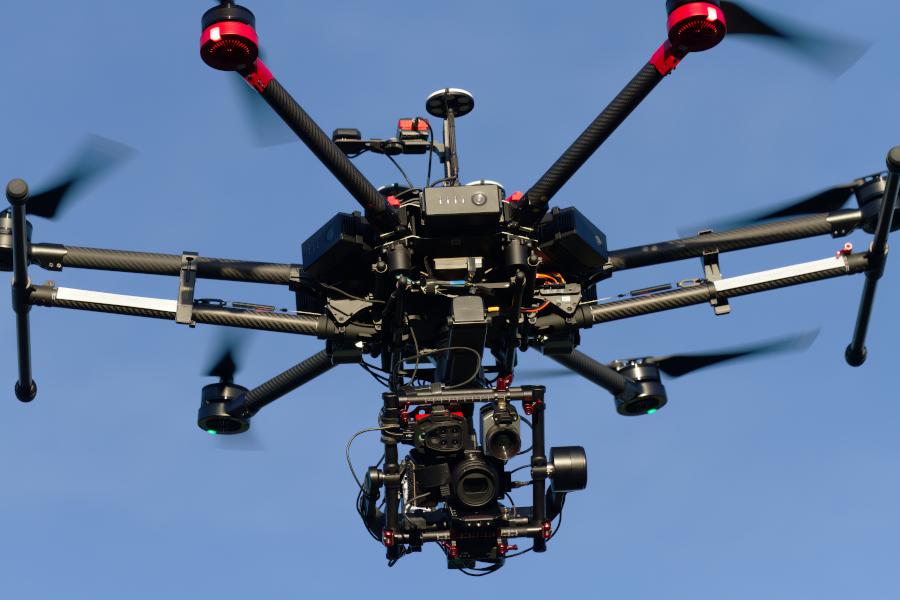
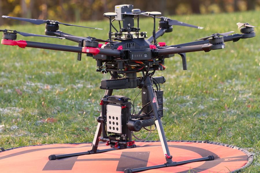
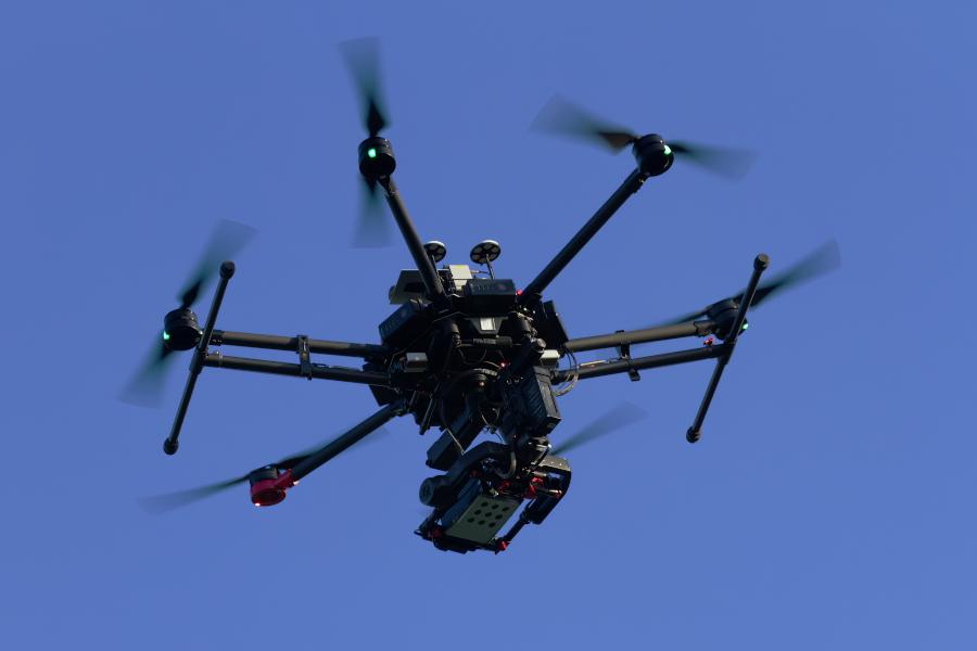
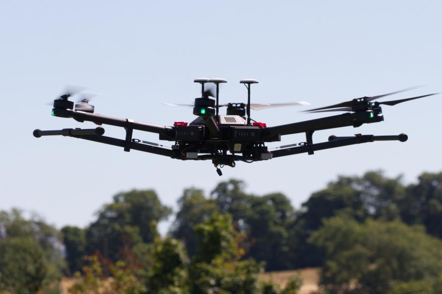
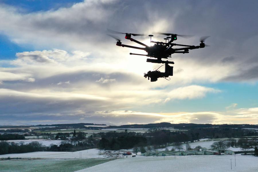
DJI M600 Pro
The DJI M600 Pro is an advanced heavy-lift unmanned aircraft capable of supporting a wide range of third party sensors.
We are able to support access to two DJI Matrice M600 Pro standard unmanned aircraft, courtesy of the School of GeoSciences' Global Change Ecology Lab (GCEL, Prof Mat Williams). These advanced heavy-lift UAS are capable of supporting a wide range of sensor packages with relatively straightforward integration.
For full specifications see the DJI website: Matrice 600 Pro - Product Information - DJI
| Max Take-Off Weight | 15.5 kg |
| Max Payload Weight | 5.5 kg (TB48S batteries); 6 kg (TB47S batteries) |
| Operating Frequency | 2.4000-2.4835 GHz 5.725-5.850 GHz |
|
Service Ceiling Above Sea Level |
2170R propellers: 2500 m;2195 propellers: 4500 m |
|
Positioning Accuracy |
Standard Positioning System (SBS), typically 2-3m but potentially lower. Note that RTK GNSS is not fitted to the aircraft, but is fitted independently to some of the supporting sensors. |
|
Max Wind Resistance |
8 m/s |
|
Operating Temperature |
-10°C to 40°C |
|
Max Flight Time |
Theoretical: TB47S batteries: No payload: 32 min, 6 kg payload: 16 min TB48S batteries: No payload: 38 min, 5.5 kg payload: 18 min |
|
Supported DJI Gimbal / sensor systems |
Ronin-MX; Zenmuse Z30, Zenmuse X5/X5R, Zenmuse X3, Zenmuse XT; Zenmuse Z15 Series HD Gimbal: Z15-A7, Z15-BMPCC, Z15-5D III, Z15-GH4 |
The Matrice 600 Pro provides a relatively open platform for 3rd party sensors. We have established a number of sensor package options utilising the Ronin-MX gimbal system as outlined below.
| SAL Maia S2 Multispectral Camera |
The SAL Maia S2 sensor provides a 9-channel multispectral capability with bands aligned to the Sentinel-2 satellite system. Our M600 integration uses the Ronin-MX gimbal to provide a stabilised platform for the main camera module, and a quick release mounting for the Irradiance Light Sensor (ILS) unit on the top of the aircraft. The sensor is supported by its own independent RTK GNSS base station for cm-level positioning. Additional Maia sensors with bands aligned to the Sentinel 2 or Worldview satellite systems are available through the NERC Field Spectroscopy Facility: NERC Field Spectroscopy Facility. |
|
TIM460 Thermal Camera + Parrot Sequoia Multispectral + Sony A6000 20 Mp camera |
We have established a multi-sensor package around the Ronin-MX gimbal, supporting contemporaneous thermal, 4-channel multi-spectral and high-resolution photogrammetry. |
| Sony A7RII photography / videography system |
Our 42 Mp Sony A7RII camera is integrated on a Ronin-MX gimbal system offering a high quality photography and videography capability. This system also provides a basic photogrammetric mapping capability, but the images are not geo-tagged, so Ground Control Points are required for geo-referencing any images, and camera settings are not adjustable in flight. |
| Other 3rd Party Sensors | The M600 platform supports a significant sensor payload, a power output for sensors, and sensor control through configurable PWM outputs. Please contact us to discuss any 3rd party sensor integrations that may be required. |
The M600 Pro uses Standard Positioning Service accuracy GNSS only, and GNSS data is not passed through to 3rd party sensors. Sensors must therefore support their own GNSS positioning measurement.
Use of Ground Control and Check Points
Where absolute positioning and / or scale accuracy are critical, it is good practice to incorporate independently surveyed ground control points (to further constrain the generated models) and / or check points (to provide an accuracy assessment of the final product). Typically 8-10 ground control points and 4-6 check points should be distributed around the survey area. If it is not possible to access the survey area for ground control point distribution and survey, then check points around the take-off and landing site may still provide a useful degree of accuracy assessment.
We operate a Leica GPS 500 and an Emlid Reach RS survey system for the survey of ground control points, check points and the location of any other RTK base station. For eligible projects more modern and compact survey systems are also available through the NERC Geophysical Equipment Facility (GEF).
We have a single large carrying case for the M600 Pro, and 3 battery cases which can take 3 sets of batteries each. These are all large and heavy units.
The M600 pro is not a person-portable system and and requires vehicular access to the flying site.
One M600 Pro is fully operational, one is requiring servicing. The sensor packages listed above are fully operational and ready for immediate deployment. Please see the 'Working With Us' section of this website for more information, and contact us to discuss your requirements.
 `
`  `
`  `
`  `
`  `
`  `
`  `
`