
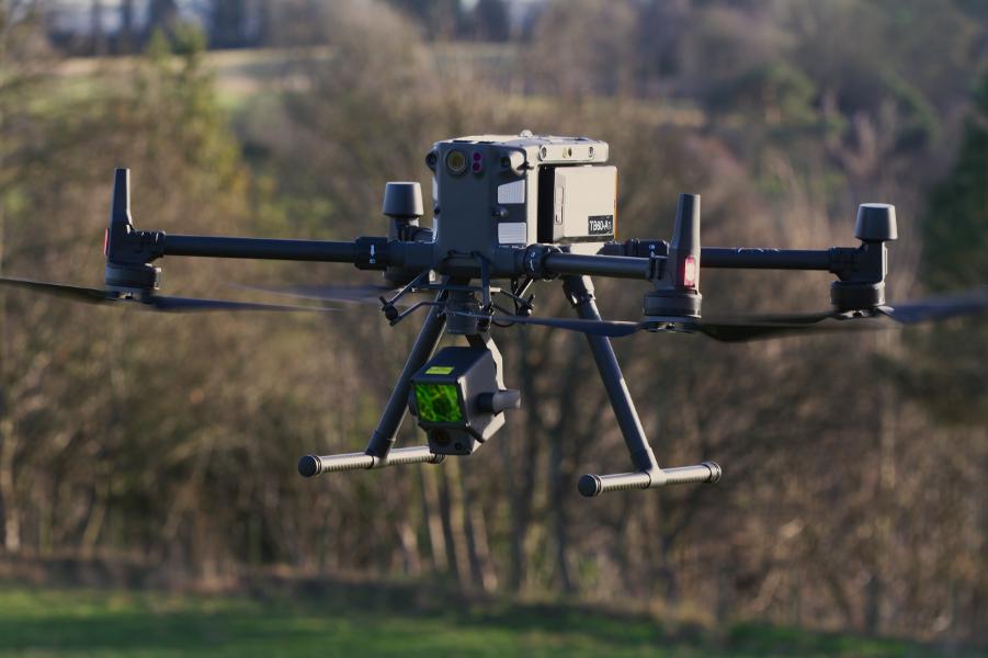
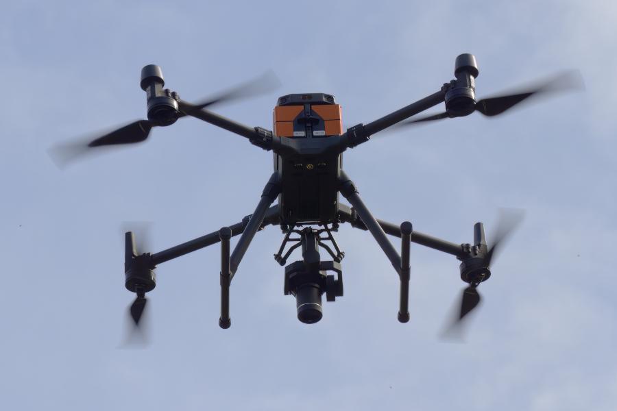
DJI M300 RTK
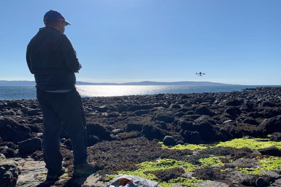
The DJI M300 RTK is the flagship of our UAS fleet, providing a state of the art platform for the latest commercially available sensors for drone survey.
Our DJI M300 RTK aircraft is a highly sophisticated platform featuring numerous advanced features for both flight safety and survey efficiency. It is compatible with our DJI-Zenmuse L1 LiDAR and 20 Mp photogrammetry sensor, our dedicated DJI-Zenmuse P1 45 Mp photogrammetry camera, and sensors available through our partners and colleagues, such as the DJI-Zenmuse XT2 thermal imaging system operated by NERC FSF. It is also possible to retrofit third party sensors such as the SAL Maia multi-spectral imager.
For full specifications see the DJI website: MATRICE 300 RTK - Specifications - DJI
| Max Take-Off Weight | 9 kg |
| Max Payload Weight | 2.7 kg |
| Max Payload for Single Gimbal Damper | 930 g |
|
Weight (with single downward gimbal and batteries fitted) |
6.3 kg |
| Operating Frequency |
2.4000-2.4835 GHz 5.725-5.850 GHz |
|
RTK Positioning Accuracy |
When RTK enabled and fixed: 1 cm+1 ppm (Horizontal) 1.5 cm + 1 ppm (Vertical) |
|
Service Ceiling Above Sea Level |
5000 m (with 2110 propellers, take-off weight ≤ 7 kg); 7000 m (with 2195 propellers, take-off weight ≤ 7 kg) |
|
Max Wind Resistance |
15 m/s (12 m/s when taking off or landing) |
|
Operating Temperature |
-20°C to 50°C |
|
Max Flight Time |
Theoretical, no payload: 55 min In practice, with L1 sensor and safe reserves on landing, assume ~ 25 - 30 min on survey per flight. |
|
Supported DJI Gimbal / sensor systems (as at 2022-02-08) |
Zenmuse XT2/XT S/Z30/H20/H20T/DJI P1/DJI L1 |
|
Supported Gimbal Configurations |
Single Downward Gimbal, Dual Downward Gimbals, Single Upward Gimbal, Upward and Downward Gimbals, Triple Gimbals Note - specific sensors need to be compatible with specific gimbal mount locations |
|
Ingress Protection Rating |
IP45 |
|
GNSS |
GPS+GLONASS+BeiDou+Galileo |
The M300 RTK supports a range of sensors from the DJI - Zenmuse stable with highly sophisticated, out-of-the-box integration and operational tools. It can also operate third party sensors either as standalone sensors operating independently of the aircraft system (apart from power, which can be provided), or with more complex support through the available SDK. Currently available sensors are listed below, but please contact us if you would like to discuss integrating any additional systems.
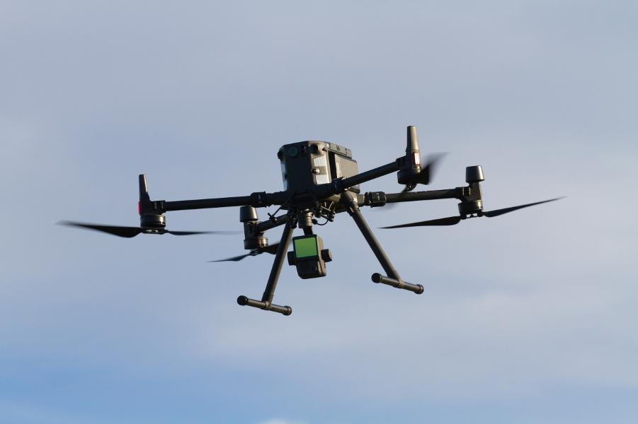
| DJI-Zenmuse L1 LiDAR / Photogrammetry Sensor |
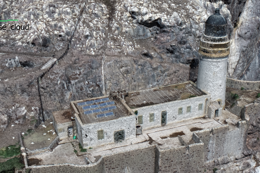
The L1 sensor combines a miniature LiDAR with a co-aligned high-quality 20 Mp RGB camera, which can be used to colourise the LIDAR point cloud or as a standalone photogrammetry tool. The sensor is fully integrated with the M300 RTK (in fact it has been designed alongside it and is compatible with no other platform at the moment). RTK positional accuracy from the M300 is passed directly into the L1 data products. The L1 is available directly from our facility. |
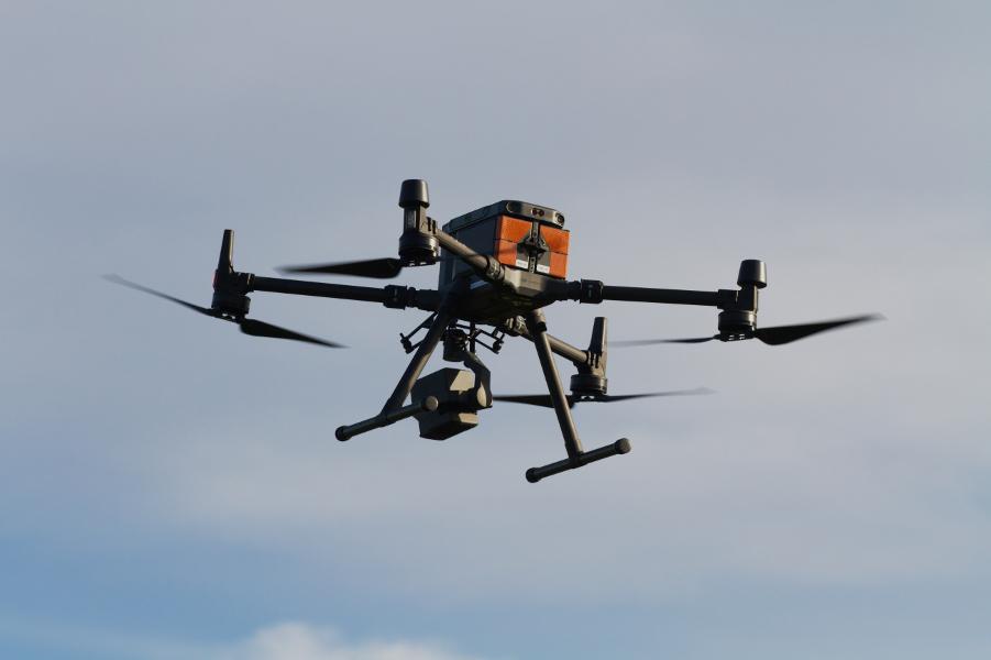
| DJI-Zenmuse P1 45Mp Photogrammetry Sensor | Our P1 photogrammetry camera provides a best-in-class, 45 Mp photogrammetry system for the M300 platform. The P1 is a full-frame camera fully integrated with the M300 system and offers a range of advanced acquisition modes which can be easily configured in a matter of seconds through the M300's controlling software. These modes include unique oblique data capture capabilities which provide exceptional quality 3D reconstructions in a highly efficient manner. |
| DJI XT2 Thermal / RGB imager |
The XT2 combines a FLIR Tau 2 thermal sensor with a 12 Mp RGB camera system, and is fully compatible with the M300 RTK system. The XT2 sensor is available through the NERC Field Spectroscopy Facility: NERC Field Spectroscopy Facility. |
| SAL Maia Multispectral Imagers (Sentinel 2 and Worldview) |
The M300 RTK can mount SAL Maia multispectral sensors on the aircraft's damped lower mount. Power is drawn from the aircraft system via an E-Port adapter, while the sensor operates under independent control and uses its own integrated RTK GNSS system. ARI possesses a Maia S2 (Sentinal 2 aligned bands) which can be installed in a matter of seconds. Additional Maia sensors with bands aligned to the Sentinel 2 or Worldview satellite systems are available through the NERC Field Spectroscopy Facility: NERC Field Spectroscopy Facility. |
| Parrot Sequoia Multispectral Imager | We have developed a mounting system for our Parrot Sequoia 4-channel multispectral cameras. The main camera unit is mounted on the aircraft's damped gimbal mount, while the Irradiant Light Sensor (ILS) is mounted on the top gimbal mount. The system is powered by the aircraft system via an E-Port adapter, but operates under independent control via Wifi. |
| Additional DJI Sensor Rental | We are able to rent the full suite of compatible sensors from DJI and Zenmuse through commercial suppliers, including the H20 series thermal / RGB sensors. Please contact us for more information. |
The M300 RTK is able to provide positional data with centimetre-level accuracy to fully supported sensors such as the L1 LiDAR, the P1 photogrammetry sensor and the XT2 thermal camera. There are various options for providing the real-time RTK GNSS corrections and translating high relative positioning accuracy to high absolute accuracy.
Using the D-RTK-2 Mobile Station
Our D-RTK-2 mobile station is specifically designed to support DJI's RTK-equipped aircraft such as the M300 RTK and Phantom 4 RTK by providing real-time corrections to the aircraft which yield cm-level relative positioning accuracy between the mobile station and the aircraft. This system is entirely stand-alone and does not require any external network or mobile connectivity, so it is suitable for use in all environments, even where strong stable 4G mobile connectivity cannot be assured.
While this relative positioning accuracy will be enough for many applications, it is important to note that the mobile station does not, by default, know it's own position in absolute terms to the same level of accuracy. To achieve cm-level absolute positioning accuracy additional steps are therefore required. There are various options as outlined below:
- If the absolute position of the D-RTK-2 mobile station is already known to cm-level accuracy by pre-survey, this data can be input directly into the D-RTK-2 during set-up in the field. The corrections are then incorporated in the real-time data transmitted to the aircraft and logged in the acquired data.
- If the absolute position of the D-RTK-2 mobile station is not known in advance, but surveyed on the same day as the flight acquisition, the accurate position of the station can be entered into the DJI Terra software during initial post-processing of the acquired data, which will then update the positional information throughout the dataset.
- We are looking into workflows to process the recorded D-RTK-2 data against external base station networks (e.g. Ordnance Survey) in post-processing, to produce an accurate reference against which to correct the acquired flight data. This would remove the need to independently survey the D-RTK-2 location. Note that this is a work in progress and not yet in place.
Using Network RTK
If a stable 4G mobile connection can be assured, it is possible for the M300 RTK to use a mobile connection to receive real-time corrections from commercial networks of RTK base stations, which negates the need for the D-RTK-2 mobile station and reduces the amount of field equipment required.
This workflow requires both a strong and stable 4G mobile network connection at the operating site and also access to a commercial RTK network with nearby base stations, which may not be available in some parts of the world. Access to such networks incurs cost, typically of around £25 / day for access to the RTK base station network, and of course any charges for mobile network access (e.g. via hotspot or dongle).
Note that while such base stations should know their own positions to high accuracy, we believe that there will be a dilution of positional accuracy with increasing distance between the selected network base station and the aircraft of around 1ppm. At time of writing we are yet to test and evaluate this workflow; due to the remote nature of the majority of our work, 4G connections cannot usually be assured and the D-RTK-2 workflow above is our default mode of operation.
Use of Ground Control and Check Points
The M300's RTK positioning system provides very accurate data tagging as outlined above. In many cases this may be considered to negate the need for any ground control points. However, for those applications where absolute positioning and / or scale accuracy are critical, it remains good practice to also incorporate independently surveyed ground control points (to further constrain the generated models) and / or check points (to provide an accuracy assessment of the final product). Typically 8-10 ground control points and 4-6 check points should be distributed around the survey area. If it is not possible to access the survey area for ground control point distribution and survey, then check points around the take-off and landing site may still provide a useful degree of accuracy assessment.
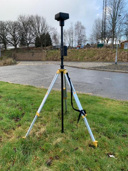
We operate a Leica GPS 500 survey system for the survey of ground control points, check points and the location of the D-RTK-2 mobile station. This is included as an optional add-on to the M300 RTK carrying system as outlined below. For eligible projects more modern and compact survey systems are also available through the NERC Geophysical Equipment Facility (GEF).
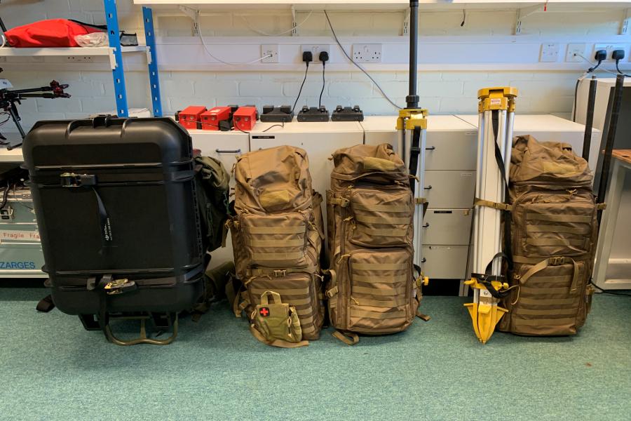
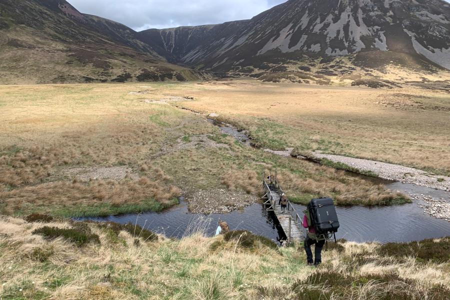
The complete M300 system is back-pack portable, typically requiring 3 loads, and an additional 1-2 loads if an independent GNSS ground survey is required.
We have developed a carrying system suitable for most deployments as outlined below. Each pack retains around 20-30 litres of free space for personal equipment.
| Pack A | The main drone hard carrying case mounted on a frame backpack. This carries the M300 aircraft itself along with the controller and a small amount of spares. Additional pouches are provided for personal kit (~20 litres total), and more can be provided when required. |
| Pack B | Flight support equipment including batteries, safety equipment and documentation. Also holds the L1 LiDAR sensor case. |
| Pack C | DJI D-RTK-2 mobile base station for precise positioning of the M300 system. This pack may be omitted if using Network RTK only. |
| Pack D |
Carries either our Leica GPS500 or Emlid Reach RS GNSS ground survey system, including the base station and rover, for independent survey of ground control and check points, where required. |
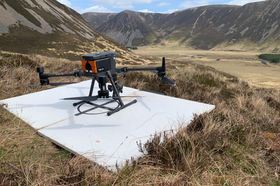
The M300 RTK with L1 LiDAR / Photogrammetry and P1 photogrammetry sensors is fully operational and ready for immediate deployment. Please see the 'Working With Us' section of this website for more information, and contact us to discuss your requirements.
We currently have 4 battery sets for the M300, each providing around 25 minutes of useful flight time. However we can support in-field recharging using our portable generator, so can essentially keep the aircraft operating all day long when we have 4x4 access.
 `
`  `
`  `
`  `
`  `
`  `
`  `
`  `
`  `
`  `
`  `
`  `
`