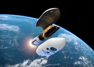
The satellite – known as Biomass – will assist scientists based at the University of Edinburgh capture and understand how the world’s carbon stores are changing, as a result of deforestation.
The five-year mission will help researchers understand the ecology of tropical forests, the most diverse ecosystems on earth, experts say.
Latest technology
Biomass’ revolutionary technology will provide accurate information to inform climate change policies, conservation efforts and protect future generations from climate breakdown.
Around a half of forest biomass is composed of carbon. Both deforestation, which releases carbon dioxide, and forest growth, which soaks it up, are crucial controls of climate change, experts say.
Powerful sensors
Biomass's sensors will be able to penetrate cloud cover to measure forest biomass more accurately than any current technology. Until now sensors were only able to scan the top of the forest canopy.
Biomass will repeatedly measure forest biomass, highlighting areas where growth is healthy, and where damage and loss are occurring.
Scientists expect it will also provide valuable insights into the diverse nature of tropical forests normally hidden from sight because of their remoteness or potential challenge to access.
Vital protection
Providing the most up-to-date and accurate data on forest biomass will help develop more accurate global and national carbon budgets, experts say, aiding efforts to protect and enhance stores of carbon to slow climate change.
Forest growth is the only proven approach to remove significant amounts of carbon dioxide, the team say, and the tropics are home to the most productive forests.
Net-zero goals
National budgets, informed by Biomass, will help governments devise effective strategies to achieve their net-zero goals, sustain their forests and monitor success.
The satellite was conceived by the University of Sheffield with support from geoscientists at the University of Edinburgh, and included collaborators across Europe. By combining British and European innovation the project has facilitated highly skilled jobs and expertise in areas such as science, design and development, assembly integration and testing.


