
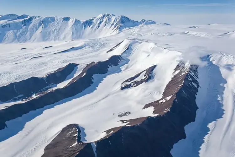
Scientists have combined a new mapping technique with satellite data to provide the most detailed view to date of the terrain underneath Antarctica – crucial for understanding the continent’s response to climate change, researchers say.
Their findings include specific geographical details of large mountain ranges, deep canyons and wide valleys, as well as some 30 thousand smaller hills and valleys.
Previous research has shown that rough areas of subglacial land - such as jagged hillsides and sharp mountain ridges - can slow the retreat of Antarctica’s glacial sheet by providing frictional resistance against the ice flowing towards the sea.
An international team, led by researchers from the University of Edinburgh, used a mapping technique called Ice Flow Perturbation Analysis (IFPA), which identifies characteristic shapes in the glacial surface generated by the ice flowing over hills and valleys.
The team combined IFPA data with the latest satellite observations to reveal the landscape across the whole continent, including previously unchartered regions.
The latest map serves as an important guide to inform scientists where future surveys should be focused, and will help develop more accurate projections of where and how much sea levels could rise in the future, the team says.
The research, published in the journal Science, was funded by the UK’s Natural Environment Research Council (NERC) and the Evans Family Foundation in the United States.