Ice-sheet and glacier melting
Our researchers have spearheaded new methods to collect invaluable satellite data and developed new computer modelling techniques to monitor and predict changes in the Earth's ice-covered regions. Our work is providing key input to climate change decision-making worldwide.

Changes taking place in the Arctic, Antarctic and other glaciated regions are drivers for disruptive global changes, especially sea-level rise, with major ramifications for people living not only in polar regions but worldwide.
We developed new data analytic methods from satellite observations, providing greater insight into terrains. We can also better pinpoint where the ocean is eroding ice under the melting Antarctic ice shelves.
Satellite observations gathered over glaciers worldwide have been critical to substantially improving estimates of the rates of ice loss and quantifying their contribution to sea-level rise.
The vast majority of ice loss is concentrated around the margins of Antarctica and Greenland and high-mountain regions such as the Himalayas, Iceland and South America. Gathering observations that are global and of sufficient spatial and temporal resolution is key to generating robust assessments of glaciers' health.
For example, our work with organisations such as the European Space Agency has shown that Greenland today is losing ice seven times faster than two decades ago.
We are among the world-leading scientists who have made crucial contributions to the Intergovernmental Panel on Climate Change (IPCC) Assessment Reports. These are the most comprehensive scientific reports about climate change produced worldwide.
Highlights
You can find out key information by clicking on each heading below:

Copernicus programme
The EU Copernicus Earth Observation programme was established to fulfil the growing need amongst European policymakers to access accurate and timely information services to better manage the environment, understand and mitigate the effects of climate change and ensure civil security.
The new cryospheric processing techniques developed by our researchers have been crucial to developing a new European Space Agency (ESA) EUR300,000,000 satellite mission concept for polar ice and snow topography monitoring within the Copernicus programme.
This objective was possible due to the techniques our researchers have demonstrated and applied, with the project now entering into its second implementation phase.
Through the programme, we are also involved with industry via the two industrial consortiums led by Airbus Defence and Space and by OHB Sweden. The direct benefit of our involvement with industry will ensure the implementation of the latest techniques and that the industrial consortium translates user requirements into sensor and spacecraft design specifications.
You can find out more about the Copernicus programme on the ESA website.
CryoSat satellite mission
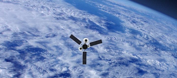
Our researchers' new algorithms have also supported the continuing development and applications of the EUR170,000,000 ESA CryoSat satellite mission, which monitors ice sheets and sea-ice volume.
Our researchers have developed new methodologies to process radar altimetry data from the CryoSat satellite, exploiting the full signal waveform to generate a swath of elevation instead of a single elevation measurement as was previously extracted. These have led to an order of magnitude increase in the resolution at which ice loss can be routinely and globally mapped from space. This methodology has been applied to reassess climate impact on ice volumes and sea-level rise contribution.
As a result, our methodology shows that Greenland today is losing ice seven times faster than two decades ago. It is also pinpointing where the ocean is eroding ice under rapidly melting Antarctic ice shelves.
It has also led to more accurate volume estimates and applications beyond the Greenland and Antarctic Ice Sheets that CryoSat was designed to monitor, such as the ice fields of Patagonia.
Data products from this have been made publicly available to the community and support a candidate satellite mission concept for the European Commission Copernicus satellite programme Sentinel.
You can find out more about the CryoSat mission on the ESA website.

CryoTEMPO programme
In 2019, based on work with researchers, the ESA launched the EUR400,000 CryoTEMPO programme.
The programme aims to provide easy to use and hassle-free products on ice-sheet and glacier changes observed by satellites for non-specialist users. It is being delivered in conjunction with our School and the start-up company Earthwave, which was co-founded by Dr Noel Gourmelen.
You can find out more about the CryoTEMPO programme on the ESA website.

The Intergovernmental Panel on Climate Change (IPCC) is the leading international body for assessing climate change.
Every five to seven years, the IPCC produces Assessment Reports. These are the most comprehensive scientific reports about climate change produced worldwide. Between the Assessment Reports, the IPCC also publishes Special Reports which focus on a specific issue.
The IPCC is now producing the Sixth Assessment Report (AR6) with contributions by its three Working Groups. The first instalment of the report by Working Group I (WGI) – the Physical Science Basis was released in August 2021.
Our contributions to the reports
Our research has made significant contributions to the IPCC Assessment Reports and the Special Reports, guiding policies around the world.
We have spearheaded new methods to collect invaluable satellite and field data and developed new computer modelling techniques to monitor and predict changes in the Earth's ice-covered regions.
Our new computer modelling techniques have helped determine oceans' impact on the flow and retreat of ice around West Antarctica and Greenland. As a result, our equations have greatly improved predictions of the Antarctic Ice Sheet's fate and its contribution to global sea-level rise over the next 200 years.
In addition, through the development of new data analytic methods from satellite observations, we are able to provide greater insight into terrains. We can also better pinpoint where the ocean is eroding ice under the melting Antarctic ice shelves.
It is largely due to our research that – for the first time – the latest AR6 report includes accurate predictions on the impact of melting ice around the margins of Antarctica and Greenland and high-mountain regions such as the Himalayas, Iceland, and South America.
Find out more:
University impact
You can also read related stories on the University Impact website:
|
Signals from a drowning world Melting ice sheets and glaciers are a startling reminder of the rate of climate change. However, measuring ice loss was an inaccurate science... until Edinburgh experts helped change things. |
Signals from a drowning world |

We also work with organisations such as the British Antarctic Survey (BAS) acquiring geophysical field data and making theoretical developments in ice-sheet numerical modelling.
Our field data acquired from the deep interior of Antarctica have been critical to constraining British Antarctic Survey models of future ice retreat from Antarctica and its consequent contributions to global sea-level rise.
You can find out more about our work with the British Antarctic Survey within the pages of this website:
Animation - Using satellites to measure glacier ice loss
- Video: geos-video-HTML media hopper satellite data glacier ice loss animation
- An animation showing how satellite data is measuring glacier ice loss at the Earth's polar regions
We have a tremendous amount of geological evidence on how the ice sheet has grown and reduced in size during the past two million years, and for the past 50 years, we’ve been able to observe these changes from satellites. But what we’ve lacked until the past decade is the necessary level of precision to fully understand how our ice sheets and glaciers are changing or make useful predictions about how these changes will affect sea levels.
Want to know more?
We've provided some useful links for you. To see the information, simply click on each heading below:
Study with us, and join one of the largest and most successful groupings of geographers and geoscientists in the UK as we address the most compelling issues of our time.
The following degrees may be of interest to you:
Undergraduate study
Postgraduate study
Postgraduate research
Check out more of our diverse undergraduate, postgraduate and research degrees and help us change the world.
Research groups
|
Cryosphere The Cryosphere research group combines field, satellite remote sensing, geophysical, geochronological and numerical modelling techniques to investigate how the cryosphere will be affected by predicted climate change, and to inform possible consequences on our society with respect to sea-level rise and water resources. |
Visit the Cryosphere research group |
|
Land Surface Dynamics The Land Surface Dynamics research group is focused on determining the Earth surface response to climatic and tectonic forcing in terms of erosional and sedimentary fluxes and the consequent geomorphology of the continents. |
Visit the Land Surface Dynamics research group |
Research institutes
Our research is carried out across our three interdisciplinary research institutes. There are also a number of research groups within each institute. Due to the interdisciplinary nature of our research, academic staff may belong to one or more groups across the institutes.
| Earth and Planetary Sciences Institute | Global Change Institute | Geography and the Lived Environment Institute |
External centres and networks
Our research enables people from different institutes within the School, other departments within the University as well as external partners and organisations to work together to address local and global challenges.
We've provided more information on our work and the role of the IPCC:
You can also read related stories on the University Impact website:
|
Signals from a drowning world Melting ice sheets and glaciers are a startling reminder of the rate of climate change. However, measuring ice loss was an inaccurate science... until Edinburgh experts helped change things. |
Signals from a drowning world |

